
Where to Bird
The following is a list of recommended birding locations in Chester County and the surrounding region. Most of the Chester County locations are described in more detail in the club publication: Chester County Birds: A Site Guide and Annotated List.
Two map icons are used in the following accounts. These are labeled only when multiples of one appears for the same site, otherwise they represent the following:
 This West Chester Bird Club logo icon is used to denote the map of a site or a route to the site created by West Chester Bird Club Member Emeritus Paul Earley.
![]() This generic map icon denotes a Google Map of the site.
This generic map icon denotes a Google Map of the site.
PENNSYLVANIA
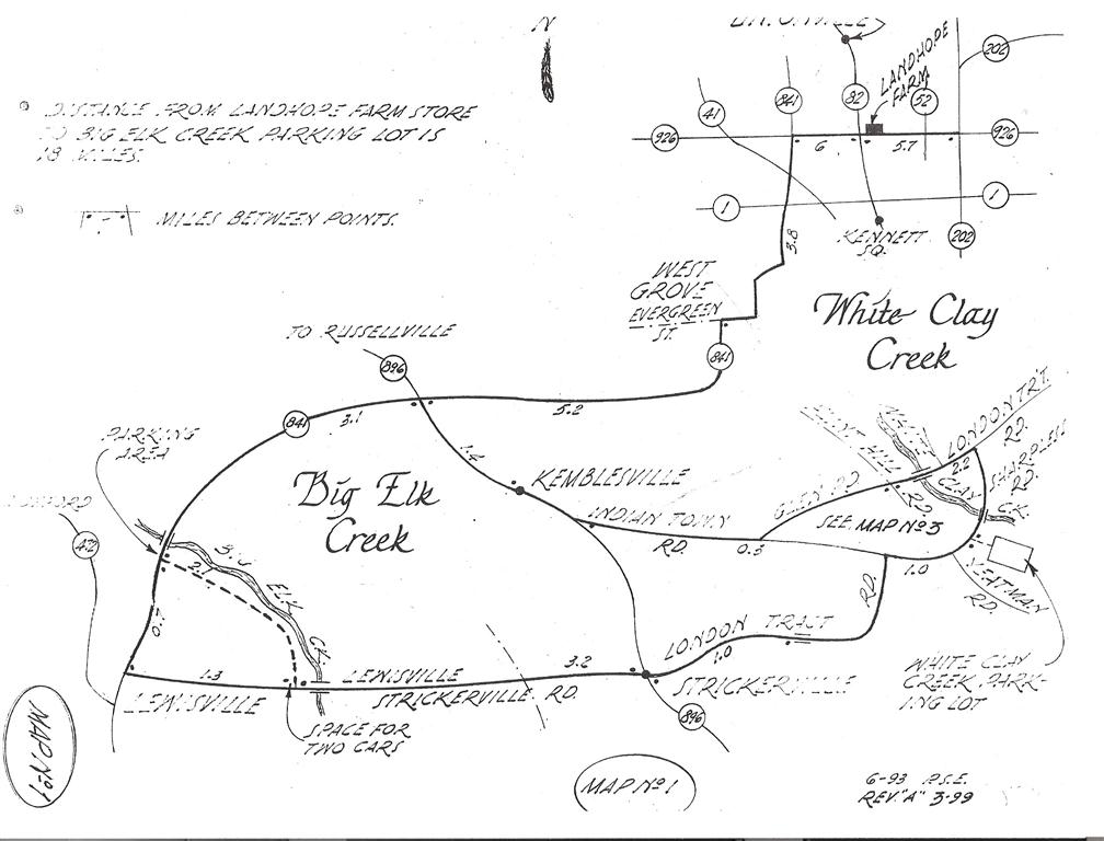
Big Elk Creek
This creek is located in southern Chester County. A two mile stretch of a dirt road adjacent to this creek can be walked. It can be very productive for migrants in the Spring.
Bondsville Mill Park
The Bondsville Mill Park is a 47 acre parcel that is being transformed into a space for passive recreation, preserving nature, and a historic site. Many bird species can be seen at the Mill Park.
ChesLen Preserve
ChesLen Preserve includes 1,263 acres of open fields, wood lots, streams, ponds and two miles of the West Branch of the Brandywine Creek. There are 12 miles of unpaved trails. This preserve holds some of the finest wetlands in Chester County.
![]()
Coatesville Reservoir
Coatesville Reservoir is a small body of water just south of Hibernia Park and Chambers Lake. It is a good location for observing wintering waterfowl.
![]()
Doe Run Area
Located slightly west of the ChesLen Preserve, the Doe Run Area has open fields that have been good for Bobolink and Grasshopper Sparrow in the past. A farm pond on Wilson Road (Doe Run Rd. on map) can be good for migrating shorebirds.

Hawk Mountain Sanctuary
Founded in 1934, Hawk Mountain Sanctuary is the world’s first refuge for birds of prey and an international center for raptor conservation. The 2,600-acre mountaintop is best known for the Fall hawk migrations but is good for passerines in the spring as well.
![]()
Hibernia County Park
Hibernia County Park located four miles north of Coatesville contains over 900 acres of woodlands, meadows, open fields, play areas, pavilions and camping areas. These diverse habitats attract a large variety of birds. In addition, the West Branch of the Brandywine Creek and the 90-acre Chambers Lake make this park one of the best birding areas in Chester County.
![]() Lyons Head Entrance
Lyons Head Entrance
![]() Chambers Lake / Wagontown Rd
Chambers Lake / Wagontown Rd
![]() Chambers Lake / Birdell Rd
Chambers Lake / Birdell Rd
John Heinz NWR
The refuge was established by an act of Congress in 1972 to protect the last 200 acres of freshwater tidal marsh in Pennsylvania. Plans are for it eventually to consist of 1200 acres of varied habitats. Over the years, the refuge has become a resting and feeding area for more than 300 species of birds, 80 of which nest here.
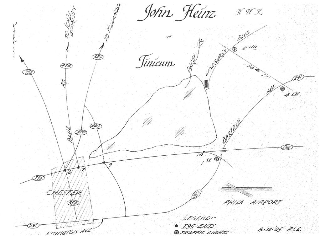 Reaching John Heinz NWR
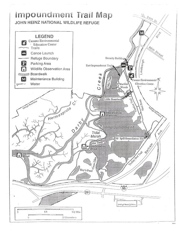 John Heinz NWR Trail Map
![]()
Marsh Creek State Park
Marsh Creek State Park is set in the rolling hills of north central Chester County. The 1,705-acre park contains the 535-acre Marsh Creek Lake, which is a rest stop for migrating waterfowl. The park is about two miles west of the village of Eagle on PA Route 100, slightly north of the intersection with the Pennsylvania Turnpike. At Eagle, signs direct you to the park.
![]() Marsh Creek Main Entrance
Marsh Creek Main Entrance
![]() Marsh Creek Lyndell Rd Boat Launch
Marsh Creek Lyndell Rd Boat Launch
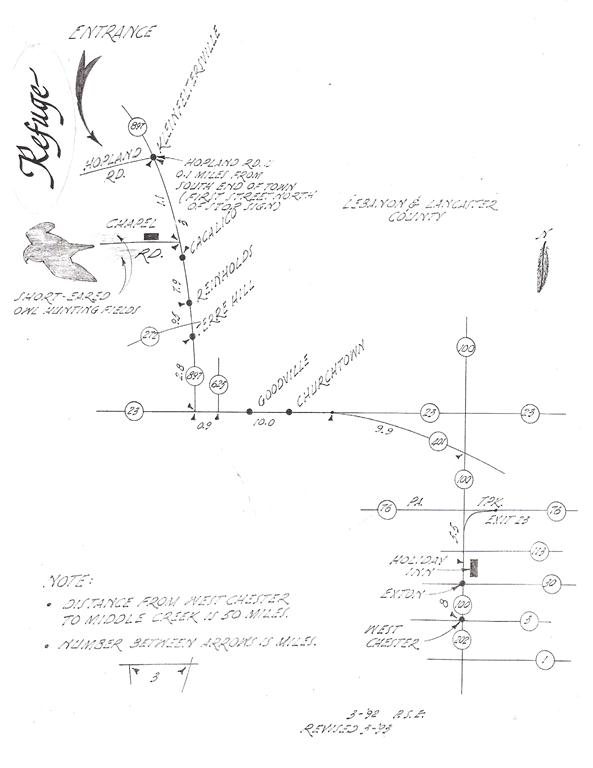
Middle Creek Wildlife Management Area
Located along the border of Lebanon and Lancaster counties, about 80 miles northwest of Philadelphia, Middle Creek Wildlife Management Area is a haven for waterfowl. Each year in early March it is the site of a great congregation of Tundra Swans and Snow Geese along with smaller numbers of a variety of other waterfowl.
Middle Creek Wildlife Management Area (PA Game Commission)
![]()
Stroud Preserve
The Stroud Preserve in East Bradford Township consists of rolling grasslands, working farmlands and woodlands. There are several spring-fed runs, wetlands and ponds which drain into the East Branch of the Brandywine Creek which flows through the property. There are 15 miles of pedestrian and equestrian trails.
![]()
Struble Lake
Struble Lake is a 386-acre impoundment in western Chester County owned by the Commonwealth of Pennsylvania and managed by the Fish and Boat Commission for public fishing and boating. The main access point is the parking area near the boat ramp off Morgantown Road. Struble is best known for wintering waterfowl and gulls and migrating shorebirds and terns. The woods and lake edge on either side of the boat ramp are also good spots to find a variety of sparrows.
![]()
Struble Trail
Struble Trail, is a paved trail that runs for 2.6 miles from the Borough of Downingtown northward along the East Branch of the Brandywine Creek. In addition to the creek the habitat is primarily mature woodlands with an occasional small open, grassy area or brushy hillside. Birding can be good at any time of year but is particularly productive during the spring migration.
![]() Meeting on Norwood Rd
Meeting on Norwood Rd
![]() Alternate location on northern trail head at Doran Mill Rd
Alternate location on northern trail head at Doran Mill Rd
Valley Forge National Historical Park
Valley Forge National Historical Park contains a little over 3500 acres of historical buildings, and natural areas of meadows and woodlands. The Schuylkill River flows through the park resulting in one portion of the park being in Chester County and the other in Montgomery County.
![]() Meet at the Chapel
Meet at the Chapel
![]() Visitor’s Center
Visitor’s Center
Waggoner’s Gap
Waggoner’s Gap is a hawk watch location near Carlisle, PA.
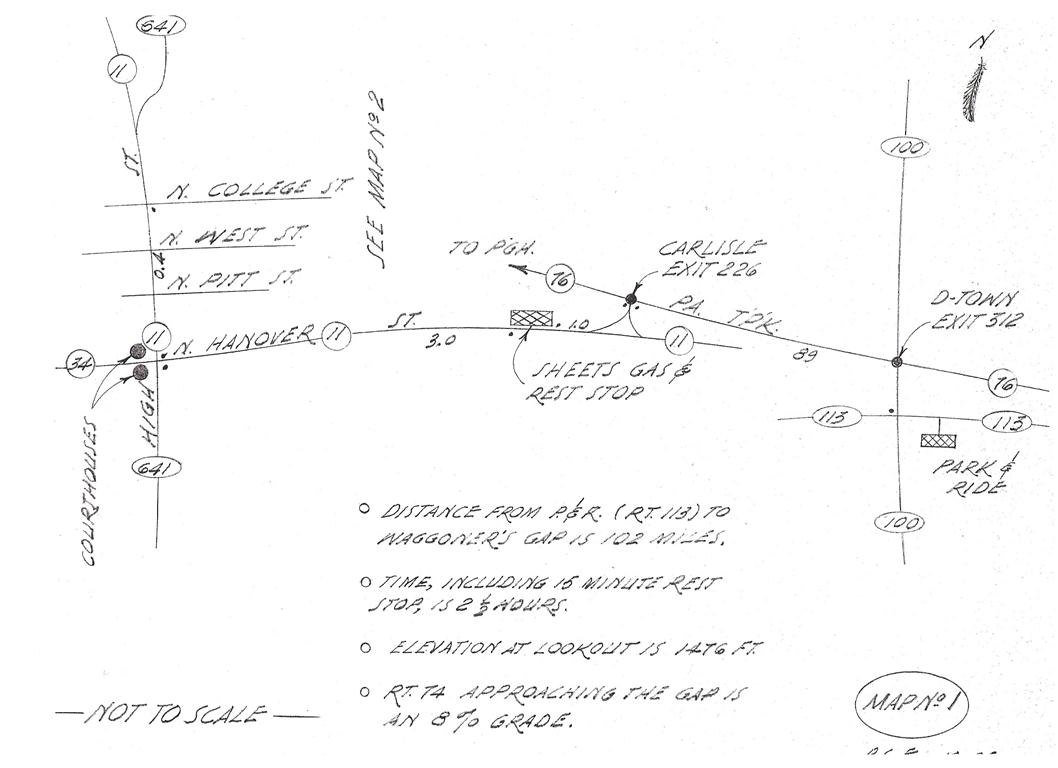 Downingtown to Carlisle
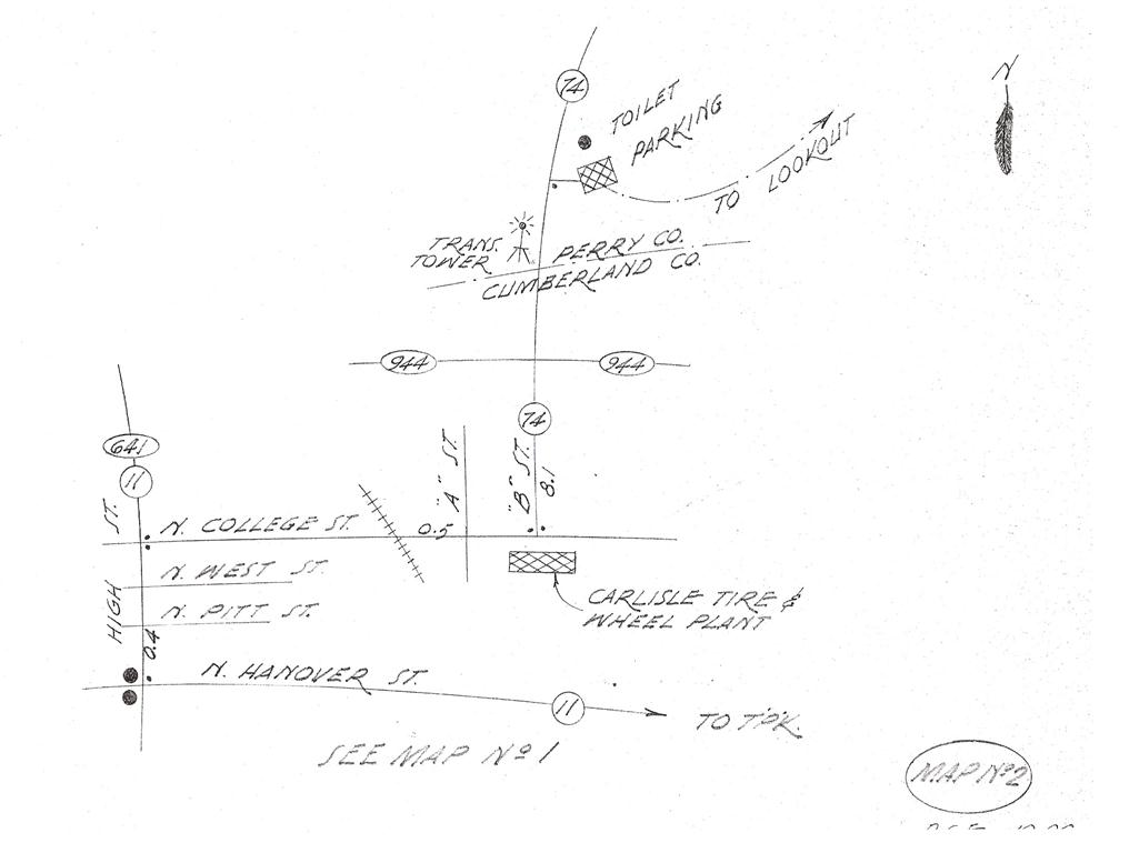 Carlisle to Waggoner’s Gap
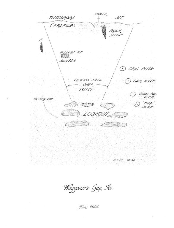 Waggoner’s Gap Lookout Info
![]()
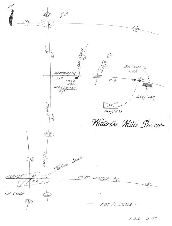
Waterloo Mills Preserve
The Waterloo Mills 170 acres include an 18th century village, mill race remnants, wildflower meadows, fertile marshes, mature woods and over a mile of the meandering Darby Creek.
![]()
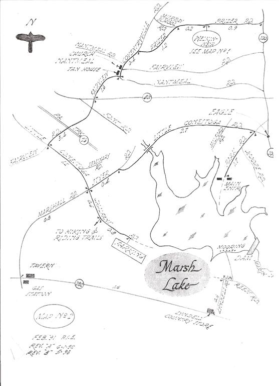
Welkinweir
Welkinweir is a 197-acre property featuring a 55-acre arboretum and historic estate house. Habitats include wetlands, meadows, and woodlands. It is the headquarters of the Green Valleys Association.
![]()
White Clay Creek Preserve
The White Clay Creek Preserve is situated in southern Chester County, three miles north of Newark, Delaware. This 1255-acre state park includes part of the White Clay Creek, and surrounding wetlands, fields and deciduous forest. The main hiking trail runs the length of the park from Parking Lot #1 to the park headquarters and beyond. The trail connects with trails in the neighboring White Clay Creek State Park in Delaware, which also provides excellent birding.
![]()
DELAWARE
A couple of sites are listed here. For additional sites see the Delaware Birding Trail.
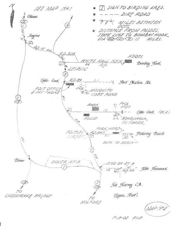
Bombay Hook NWR
Bombay Hook National Wildlife Refuge is located near Smyrna, DE. Tidal marsh, mudflats, upland forest and brushy areas are among some of the habitats it provides. There is a 12 mile auto tour that affords excellent views for observation of birds, five walking trails, and three observation towers. It is managed primarily for waterfowl and shorebirds.
South of Bombay Hook NWR there are a number of other good birding areas (Port Mahon Rd., Little Creek Wildlife Area, etc.) shown on the second map below.
 West Chester to Odessa
 Odessa to Bombay Hook & Beyond
![]()
![]()
White Clay Creek State Park / Friends of White Clay Creek State Park
![]()
MARYLAND
Conowingo Dam (& Muddy Run Reservoir, PA)
Late in the year Bald Eagles gather in large numbers below the dam along with a good selection of gulls. Late November is the best time to visit. North of the dam there are a number of places to bird including the vicinity of Muddy Run Pumped Storage Reservoir in Pennsylvania.
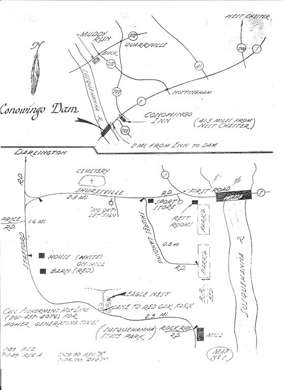 Conowingo Dam and Environs 1
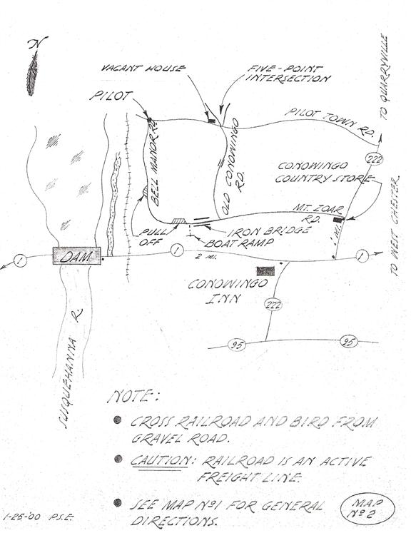 Conowingo Dam and Environs 2
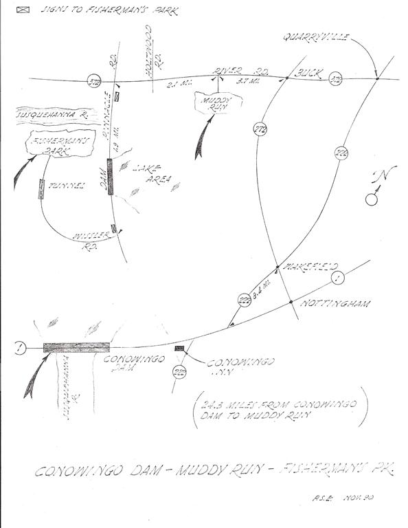 Fisherman’s Park near Muddy Run Reservoir
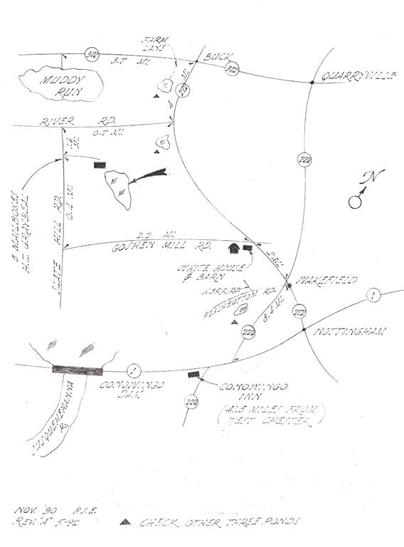 Ponds near Muddy Run Reservoir
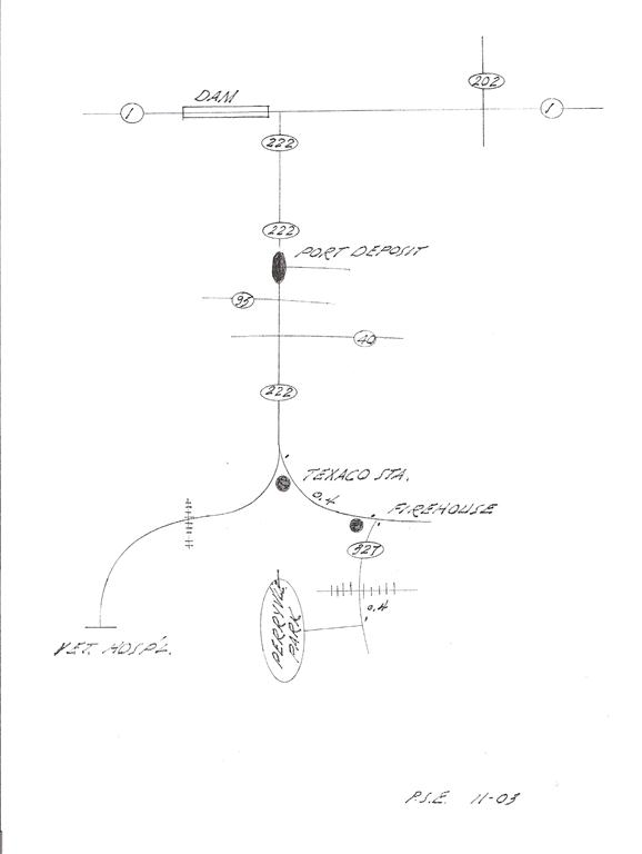 Perryville Park below Conowingo Dam
![]()
Eastern Neck Island
This 2,285-acre island refuge is a major feeding and resting place for migrating and wintering waterfowl. Nearby Remington Farms is also a good for observing waterfowl.
 West Chester to Remington Farms
 Eastern Neck Island
![]()
NEW JERSEY
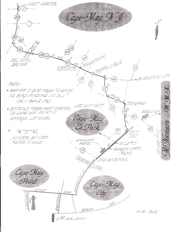
Cape May Point
Cape May Point is one of the top birding sites in North America. Some would say there is no finer place in North America to watch migrating hawks than the Cape May Point State Park. Additionally the shape of the cape funnels all migrating species of birds into tighter quarters making for a phenomenal birding experience.
Cape May Bird Observatory (CMBO)
![]()
E.B. Forsythe (Brigantine) NWR
The Edwin B. Forsythe National Wildlife Refuge contains more than 47,000 acres of southern New Jersey coastal habitats which are actively protected and managed for migratory birds.
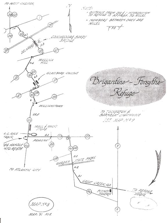 E. B. Forsythe via Rt. 322
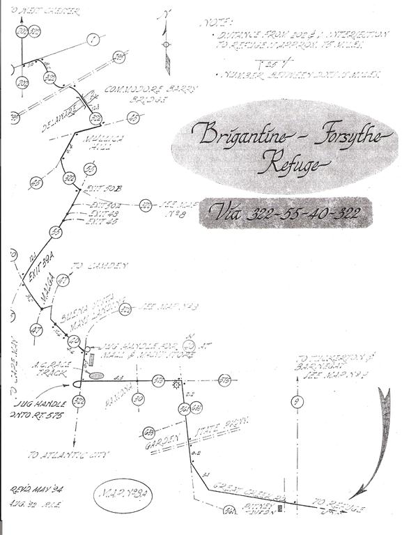 E. B. Forsythe via Alternate to Rt. 322
![]()
Fortescue & Heislerville (Glades Wildlife Refuge)
Glades Wildlife Refuge is a 7,500-acre expanse of diverse landscapes: vast tidal marshes, wooded uplands, beaches along the Delaware Bay, and a remarkable old growth forest. Once part of New Jersey’s agricultural and maritime economy, the refuge is Natural Lands Trust’s largest single preserve.
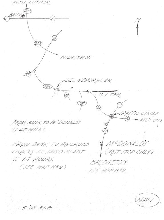 West Chester to Bridgeton
 Bridgeton
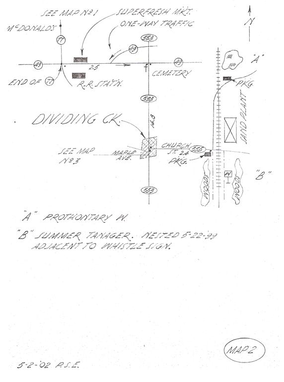 Bridgeton to Dividing Creek
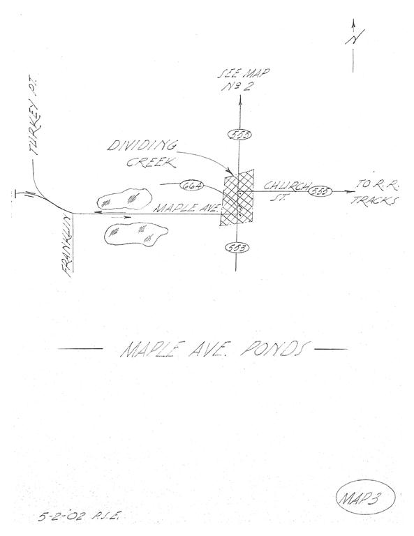 Dividing Creek to Maple Ave. Ponds
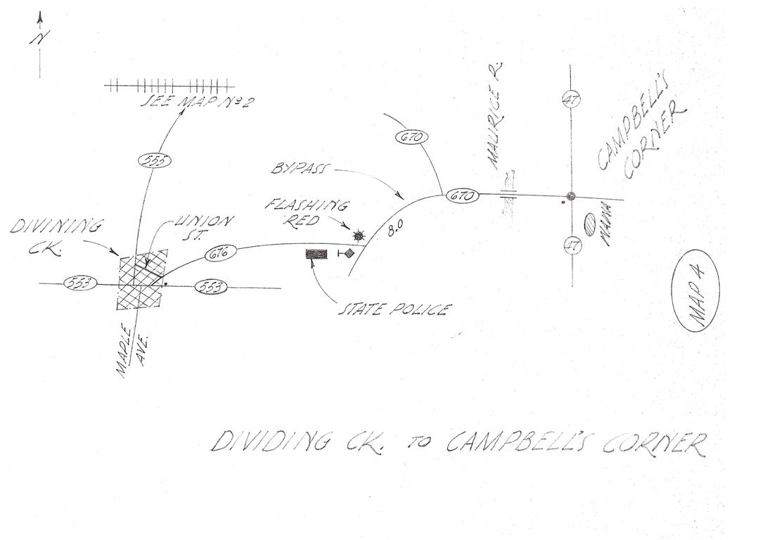 Dividing Creek to Campbell’s Corner
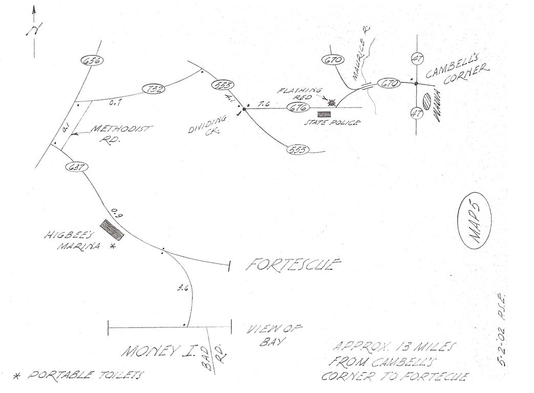 Campbell’s Corner to Fortescue
 Campbell’s Corner to Matt’s Landing (Heislerville)
 Matt’s Landing to East-Point Lighthouse
![]() Fortescue
Fortescue
![]() Heislerville Fish and Wildlife Management
Heislerville Fish and Wildlife Management
![]()
North Jersey Coast (Shark River Estuary, Barnegat Light, etc)
A good trip for winter waterfowl, this covers several spots that have the potential to host a vagrant. Shark River Inlet was a reliable winter place to find a Barrow’s Goldeneye for several years.
 West Chester to Shark River Estuary
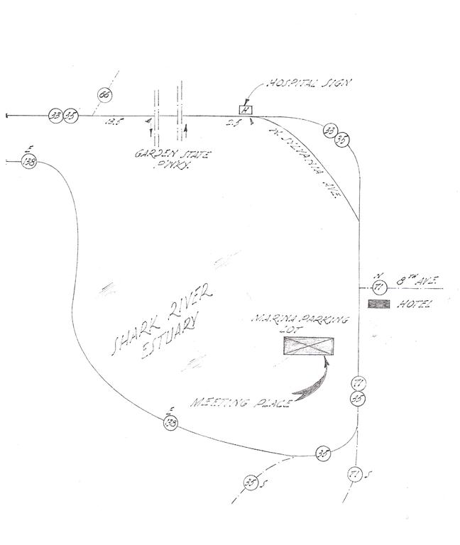 Shark River Estuary Map 1
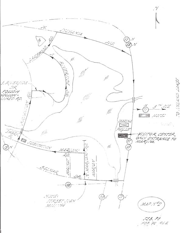 Shark River Estuary Map 2
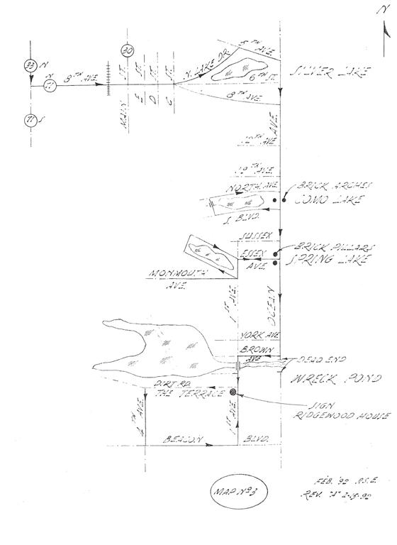 Wreck Pond
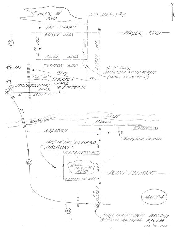 Wreck Pond to Pt. Pleasant
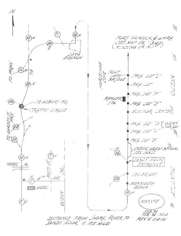 Shark River to Sandy Hook
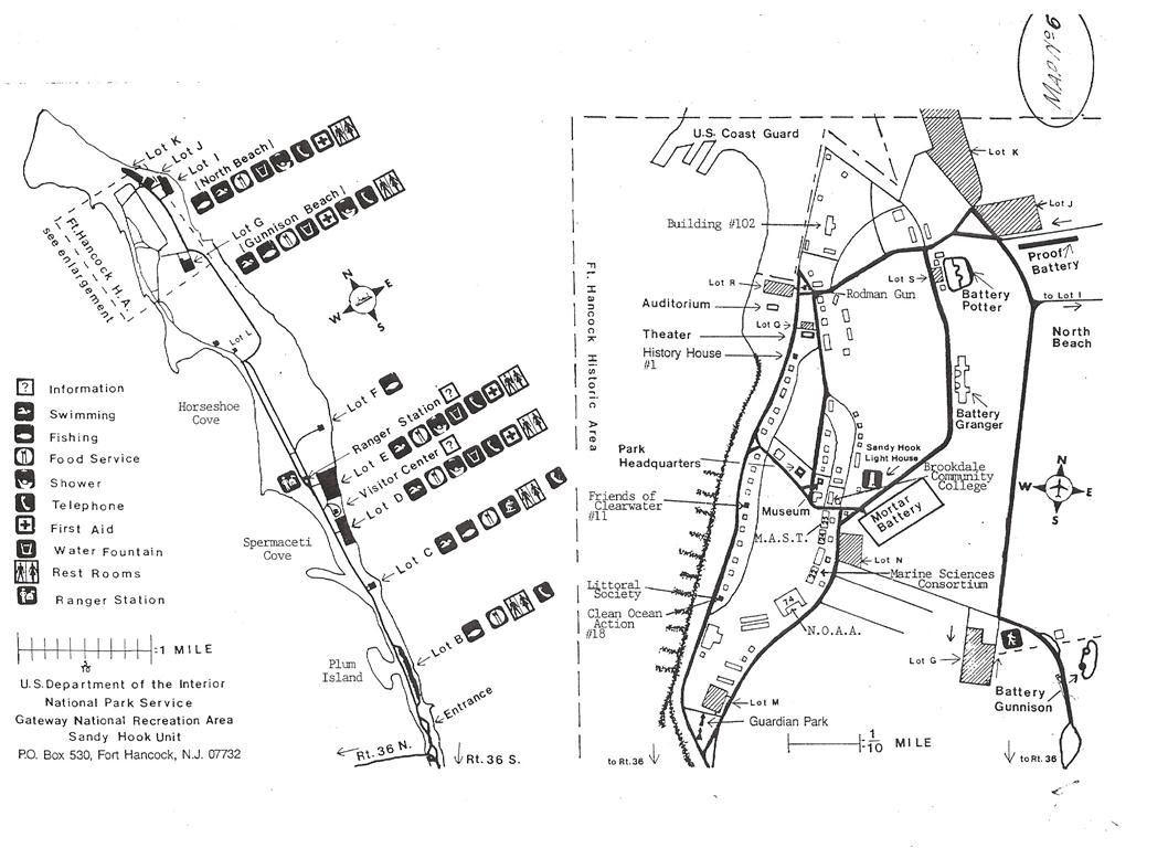 Sandy Hook
![]() Shark River Marina
Shark River Marina
![]() Silver Lake
Silver Lake
![]() Wreck Pond
Wreck Pond
![]() Sandy Hook
Sandy Hook
![]() Shark River Marina
Shark River Marina
![]() Silver Lake
Silver Lake
![]() Wreck Pond
Wreck Pond
![]() Sandy Hook
Sandy Hook
![]() Barnegat
Barnegat
[rps-include post=415]